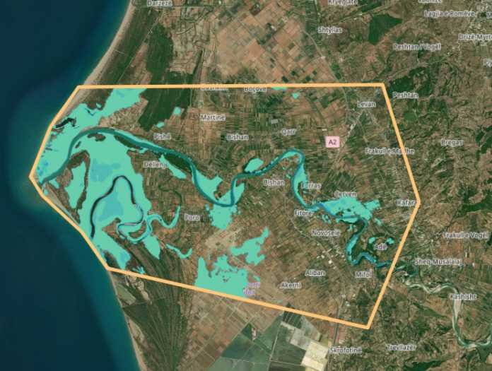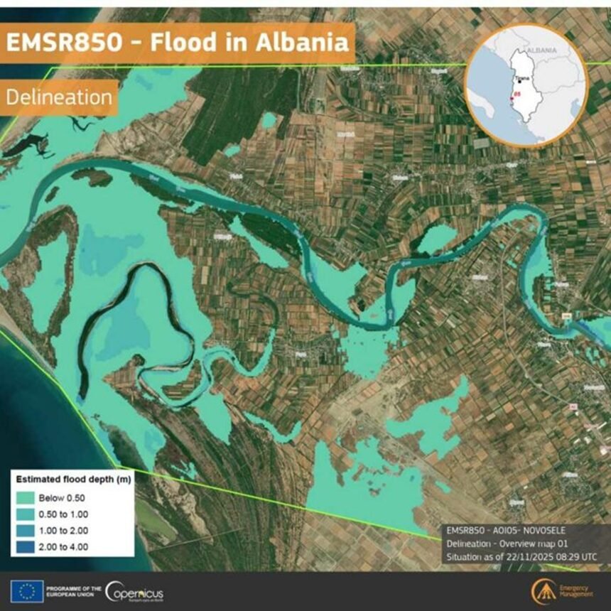
Intense rainfall over the past days has caused numerous problems in several areas of Albania, while the European Union’s satellite system for monitoring natural emergencies, Copernicus, has released detailed images of the floods that hit the Vlorë–Novoselë area over the weekend.
According to the latest assessment of the Novoselë boundary (AOI05), the situation is as follows:
- 190 hectares of land are submerged
- Approximately 220 people are affected by the floods
- 5.8 hectares of built-up areas and 20.6 kilometers of roads are damaged
- 72 hectares of the airfield are affected
Copernicus imagery provides a clear overview of the scale of the damage and helps authorities plan interventions for managing the situation.