The Mediterranean is experiencing one of the hottest and most destructive summers in recent years, with hundreds of wildfire outbreaks recorded across the region.
NASA has released satellite images clearly showing the spread of flames in various countries including Greece, Spain, Italy, Cyprus, southern France, and Albania.
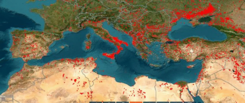
The images captured by NASA’s satellite system document active fire zones in real time. Each red dot on the satellite maps represents a small or large fire that is scorching vast green areas, mostly forested regions.
Data collected by the American space agency provide a detailed view of developments over the past 24 hours and the previous week, which has been among the hottest of this summer.
According to NASA, the spread of the fires has been fueled by extreme temperatures affecting the Balkan Peninsula and parts of Italy. In many areas, the situation has worsened due to strong winds and the lack of rainfall.
While most of the red zones represent wildfires in forests, NASA warns that some may be linked to other human activities, such as controlled burns by farmers, industrial processes, or explosions tied to the conflict in Ukraine.
Authorities in the affected countries continue efforts to bring the situation under control, while residents are being warned of the increasing risk posed by the advancing flames.