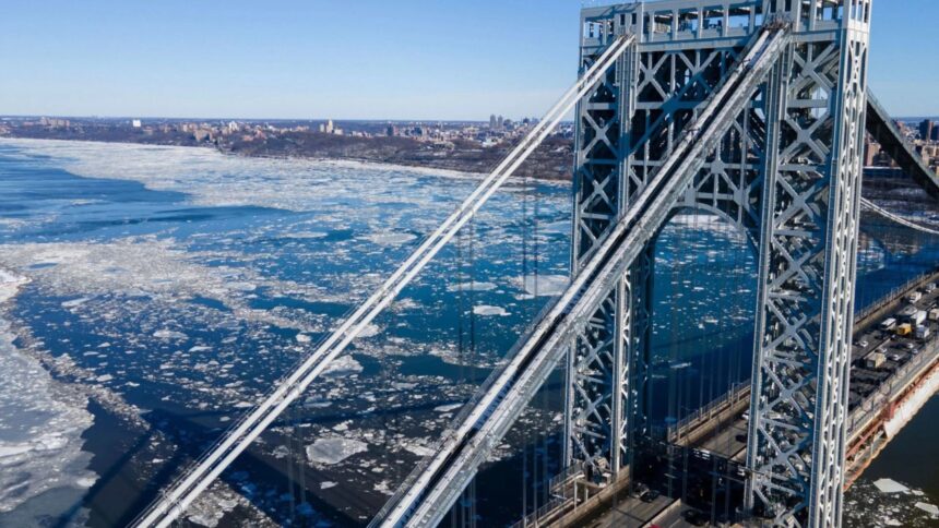
New York City is experiencing extreme cold that has surpassed even polar conditions, with temperatures in some areas falling lower than parts of Antarctica.
On Sunday, the city recorded temperatures of around –16°C, with wind chills near –26°C.

The U.S. National Weather Service issued life-threatening cold warnings, confirming that this is the longest stretch of extreme low temperatures in more than a decade for some areas.
According to meteorological data, temperatures in parts of northeastern Mexico plunged to nearly –40°C.
By contrast, the U.S. McMurdo Station in Antarctica recorded temperatures of around –6°C, making it roughly 10°C warmer than New York City at the peak of the cold wave.
The stark contrast was explained by a powerful Arctic air mass descending from north of Hudson Bay, Canada, moving southward and covering large portions of the eastern United States.
The phenomenon triggered extreme cold warnings for more than 43 million people, including major metropolitan areas such as New York City and Philadelphia.
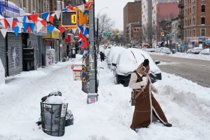
Conditions were worsened by strong winds and, in parts of New England, heavy localized snowfall caused by an atmospheric system that produced intense snow bands with rapid accumulation.
In upstate New York and northern New England, temperatures dropped to between –29°C and –34°C. Meteorologists warned that exposed skin could freeze in under 30 minutes under such conditions.
In recent weeks, at least 17 people have died in New York City due to exposure during the cold wave, with 13 deaths confirmed as directly caused by hypothermia.
Mayor Zohran Mamdani said the city has activated emergency operations to assist the homeless population.
Meanwhile, 60 warming centers were opened across the city’s five boroughs, along with buses converted into mobile shelters and assistance stations in high-traffic areas, including Midtown Manhattan. Authorities reiterated that even brief outdoor exposure can be dangerous and urged the public to contact emergency services if they see someone at risk.
Although the episode has been described as one of the most intense in more than 20 years, meteorologists predict a gradual improvement.
By early next week, daytime temperatures are expected to return to around 0°C, with a warming trend heading into early March.