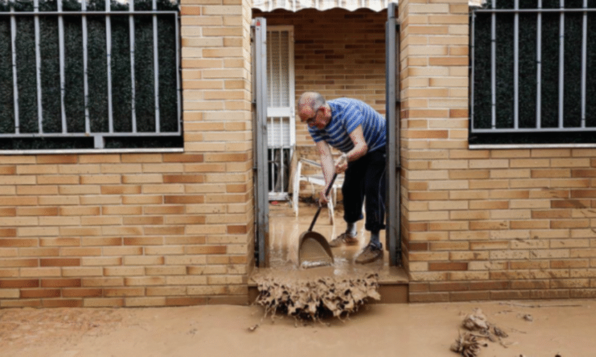
MADRID, Spain – July 12, 2025 – Spain is experiencing a dramatic weather paradox, with severe warnings issued for storms and hail in the north, while the south continues to endure extreme heat. A significant storm system, known as DANA (Depresión Aislada en Niveles Altos, or isolated depression at high levels), has triggered widespread alerts across 25 provinces.
In a striking incident, 100 mm of rain fell in just one hour in a popular tourist area, leading to flooded cars and homes. Spain’s National Meteorological Agency (AEMET) has activated red, orange, and yellow warnings for numerous Spanish regions. Eight provinces, including Huesca, Teruel, Zaragoza, Barcelona, Girona, Lleida, Tarragona, and Castellón, are under an orange alert for severe storms this Saturday, anticipating torrential rains and potential flash floods that could disrupt holidays and cause significant damage.
Flooding in the North and Military Intervention
Up to 50 liters of rain per square meter are predicted for many areas in Aragon and Catalonia, which could lead to localized flooding and overflowing rivers. The banks of the Ebro River in Tarazona, Zaragoza province, were under a red alert for major flooding on Friday. A red alert remains in effect until late Saturday, as the storm has caused urban flooding and disrupted traffic in tourist areas. The Military Emergency Unit (UME) has been deployed to several cities in Zaragoza to assist in the aftermath of the extreme rainfall.
Local rescue services have reported over 30 flood-related incidents, including fallen trees and blocked roads, though no casualties have been reported. Shocking footage shows cars floating in floodwaters as torrential rain submerges streets, with people seeking shelter from the dangerous weather.
Storm warnings have also been issued for other regions, including Alicante, Valencia, Ribera del Ebro in La Rioja, Iberico in Rioja, and Alava. The Spanish National Meteorological Institute attributes the unstable weather to a mass of unstable air moving across the north and east of the Iberian Peninsula, bringing heavy rain and thunderstorms. The storm is expected to spread to the Cantabrian coast, the Balearic Islands, and parts of central and eastern Spain later in the day, with the situation anticipated to calm overnight.
Extreme Heat Persists in the South
Meanwhile, as parts of the country are battered by rain, the south and southeast of Spain continue to suffer from extreme heat. Temperatures in Murcia, Alicante, inland Andalusia, and parts of Extremadura could reach over 40°C.
This stark contrast between intense heat and severe storms makes the weather situation particularly challenging. In the coming days, temperatures are expected to drop across most of mainland Spain and the Canary Islands. However, winds will increase, especially in the Canary Islands and along the Alboran coast, where they could reach very strong intensities.
The storm is attributed to the DANA meteorological phenomenon, also known as a “cold drop.” This phenomenon occurs when a large mass of warm, moist Mediterranean air rises into the upper atmosphere after a cold front arrives over land. The temperature difference between the cold air in the upper layers and the warm air on the ground causes instability, leading to the sudden development of storms and heavy rainfall.


