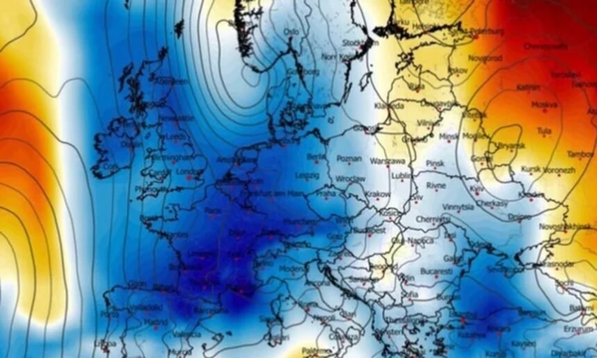
A powerful atmospheric system is causing major weather changes across Europe, bringing cold air from the north toward the south and creating conditions for a period of extreme weather in several regions, according to the meteorological service Severe Weather Europe.
Forecasts indicate that the collision between cold air and warm, moist Mediterranean air is creating favorable conditions for severe storms, including supercells, large hail, and localized flooding.
The most at-risk areas include northern Italy, the Adriatic coast, and parts of the Western Balkans, where organized storms and heavy rainfall are expected, especially in mountainous regions.
Meteorologists say the changes are being driven by a high-pressure system over the North Atlantic, which has allowed cold air masses to move into central and southern Europe.
This has led to the formation of a strong cyclone affecting temperatures significantly.
In parts of Western and Southwestern Europe, temperatures are expected to drop by 10–14°C below seasonal averages, with mornings near freezing and frost risk. Even daytime temperatures will remain well below normal.
In the Alps, snowfall of up to 50 cm is expected, while some areas in the Balkans and Italy could receive 100–150 mm of rain within a few days.
However, forecasters expect conditions to improve next week as the cold system weakens, with a gradual rise in temperatures and the possibility of a new warm spell toward the end of the month.