

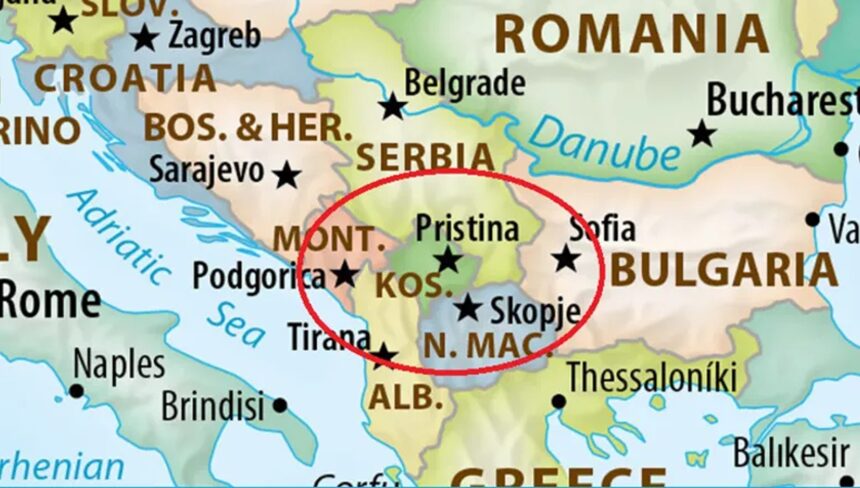
The United Nations General Assembly voted to adopt a new world map designed to reflect the true relative sizes of countries, after African nations called on the UN to correct what they described as a centuries-old distortion.
The “Correct the Map” resolution, introduced by member states of the African Union along with the Bahamas, was approved by an overwhelming majority. A total of 164 member states voted in favor, while the United States was the only country to vote against it. Six countries abstained: Serbia, Estonia, Georgia, Lithuania, Moldova, and Ukraine.
Why did Serbia not support it?
The proposed resolution “corrects a historical injustice” in the way and geographical scale of certain parts of the world are represented. However, it uses Equal Earth projections that depict Kosovo as a separate state and therefore could not be supported, even indirectly, Serbia’s Ministry of Foreign Affairs told BBC Serbian in its response.
The resolution, meanwhile, aims to provide a “fair” representation of regions across the globe, particularly Africa, arguing that distortions in the current world map have resulted in the continent being symbolically “minimized” in people’s collective imagination.
Currently, many world maps are based on the Mercator projection, created by European cartographer Gerardus Mercator in 1569. It is widely used for navigation because lines running north to south maintain a constant true direction relative to the Equator.